
 |
A Spectacular Drive
It’s a spectacular drive, and it’s worth going down there even for just a quick glimpse of the sunset. The cliffs of Chugach State Park crowd the Seward Highway and the Alaska Railroad against the sea. There are mountains, ocean, rivers, dall sheep, and cozy mining towns, like Crow Creek and Hope. These are good places to picnic and hike. |
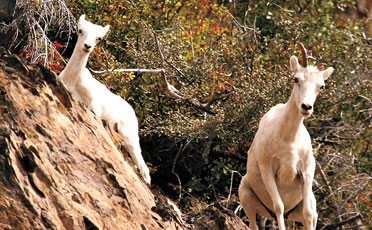
Let somebody else drive as you scan for waterfowl, eagles, sheep, bears, moose, salmon & beluga whales on this stretch of road. Please use the many pullouts and viewing areas, and be sure to fully pull off the road. |
Potter Marsh, one of Alaska's best birdwatching spots, is just 12 miles from downtown Anchorage. It has a parking lot, toilets, and a great boardwalk. Here's how to get to Potter Marsh. When you're heading south out of Anchorage, look for the left hand turn just after the road goes under an overpass. The Rabbit Creek rifle range is to the right. The Chugach mountains, shown in the photo, are to your left.
|
The marsh has over 130 bird species, salmon, and small animals. |
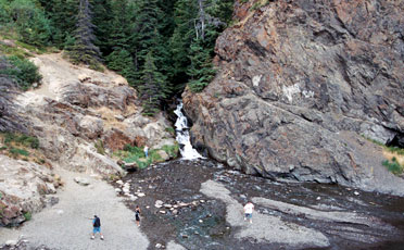
Stay Off the Mud Flats The silty mud flats at Ship Creek and further down Turnagain Arm are surprisingly dangerous. The mud here is a colloid – a substance that shifts from solid to liquid at a second’s notice. Every year, people get stuck in these flats, and the suction doesn’t release them. Firemen with boards and special rescue equipment have to come and save them. In 1988, Alaskans were horrified at the tragic story of a young woman who drowned in the deadly incoming tide, while surrounded by frantic rescuers who never managed to get her out. Shown here are two separate incidents in two different years. The story on the left is on Channel 2 KTUU and the one on the right is in the Anchorage Daily News. |
Anchorage is at mile 127. The numbers go down as you drive south. The Sterling Highway leaves the Seward Highway at Mile 37, 90 miles south of Anchorage. It travels west across the Kenai, ending at Homer. The Sterling Highway mile markers don’t start at zero, but at 37, so you’ll find distances on the Sterling Highway to be 37 miles closer than the mile markers indicate. |
Crow Creek is an almost intact gold mining camp, 3 miles up a valley road from the Alyeska Ski Resort at Girdwood. Crow Creek was a lucrative mine. You can still pan for gold near the original 1898 buildings. |
|
Girdwood used to be called “Glacier City.” Part of the municipality of Anchorage, Girdwood has a much more laid-back lifestyle. Girdwood’s the ski capital of Alaska. In the summer it’s the base for serveral rafting and adventure operators, as well as home to a large resort hotel with a tram to the top of the mountain. |
Hiking, Biking and Fishing Along Turnagain Arm
The short trails go down along the arm and offer views of the ocean. The long trails go back into the mountains and connect to Eagle River, north of Anchorage. Stop at Potter Marsh, mile 117.4 (mtn. side); McHugh Creek, mile 112 (mtn. side); Beluga Point, mile 110 (ocean side); Bird Creek access, mile 101 (mtn. side); Bird Point overlook and bike trail, mile 96.5 (ocean side). |
As you drive south into the Kenai Peninsula, you’re surrounded by Chugach National Forest all the way to Cooper Landing on the Sterling Highway, and to just outside of Seward. Forest lands also cut across Prince William Sound, and to the Copper River Delta on the east. + Get the Bearfoot map showing Chugach National Forest here. |
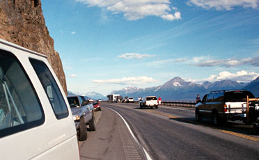
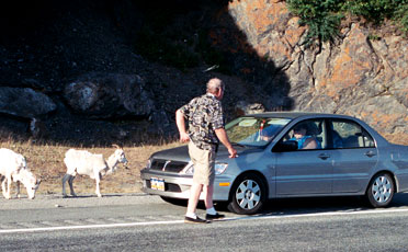 Watch for Traffic
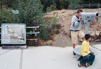
 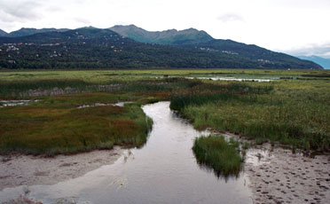 Potter Marsh
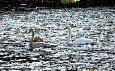


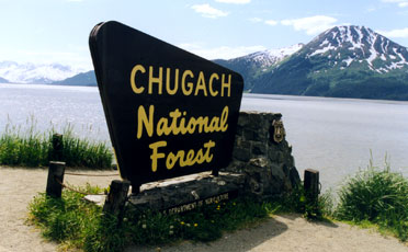 Chugach National Forest
|
|
|
|